Marine Navigation 8.5.00
Paid Version
Publisher Description
Marine Navigation - Offline GPS tracker for boat navigation. GPS Chartplotter for Sailing & boating
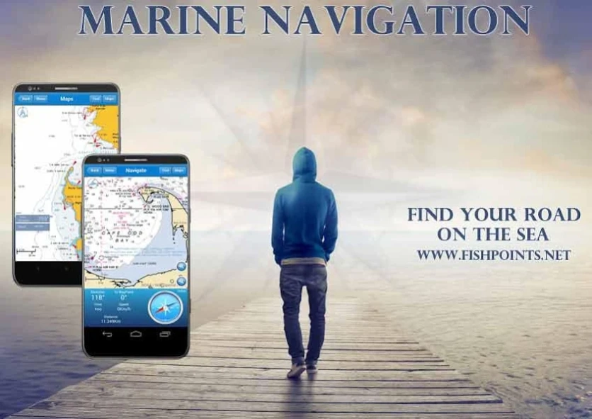
MARINE NAVIGATION
Find your road on the sea! GPS chartplotter for boating.
An easy-to-use offline GPS tracker and route planner featuring worldwide offline maps.
Buy once and for all, without any subscription
Navigate with your favorite device around the world, turn your smartphone or tablet into a GPS navigator with an offline map, ideal for sea, rivers and lakes, for boaters, fishermen and water sports.
This application is dedicated to the sea and the people who love it and live it with passion.
WHAT MAKES IT A BEST GPS TRACKER OR NAVIGATOR:
Offline GPS tracker for boat navigation. GPS Chartplotter for Sailing & boating.
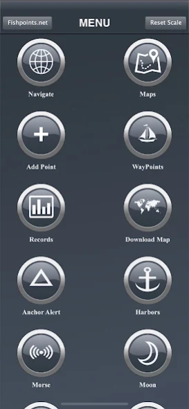
Morse Code in case of danger, Anchor Alert to prevent the drift of the anchor, Moon Phase to show the phases of the moon during the day, Harbors to see the list of ports, Sync Waypoints to be able to create backups and access them from different devices.
You also get to download the maps and marine charts, so you won’t need an active internet connection when it comes to getting navigation and route planning. If you create a profile, you can save waypoints and routes to access them from different devices. All you have to do is logging in with the same account and enjoy seamless sea GPS navigations.
So, no matter you are a professional sailor or fisherman, or you are an amateur who like traveling in the sea, Marine Navigation has got you covered. It’s a versatile sea navigator app and boating route planner which provides accurate GPS Chartplotter and marine charts.
MAPS OFFLINE:
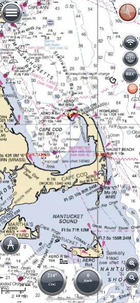
You can download maps or marine charts, you need a select area and application save tile into your device. You can navigate on preloaded maps or charts without connection.
MAPS AND MARINE CHARTS:
MapView: http://www.fishpoints.net/mapsview/
•Nautical maps of the United States of America by NOAA
•Nautical maps of the Mediterranean by NOAA
•Mediterranean RNC
•Nautical maps of the NewZealand by LINZ
•Maps of the world’s oceans and coastal areas by ESRI
•World topographic map includes boundaries, cities, water features, ports, physiographic features by ESRI
•Satellite imagery for the world by ESRI
•Maps for the sea, with ports, sea light and more by Open Sea Map
Marine Navigation: GPS Tracker Main Features at a Glance
•Super easy to use GPS tracker tool
•Clean and neat design
•Available in different languages: English, Italian, French, Spanish, Brazilian, Turkish and German,Indonesian
•Download Maps to use in offline mode
•Accurate and detailed GPS Chartplotter, GPS plotter and Marine charts
•Optimized for phones and tablets
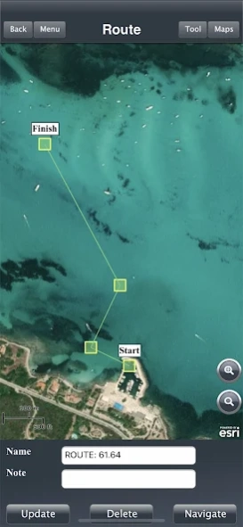
•Sync routes and waypoints to access them anywhere from any devices
•Moon phase
•Morse Code
•Receive information about speed, direction, time to arrival
•Compass
•Change Measurement Units: Km, Mi, or Nmi
•Record your route for analyze the data and renavigate your trace
LOCATION PERMISSION
The app needs your location to trace the route on the map.
Location information is processed locally on your device, ensuring your privacy.
HELP US
Download Marine Navigation and let us know about any bugs, feature requests or any other suggestions. Stay tuned for more features and options in this GPS tracker app for boating.
WARNING
Good seamanship requires the use of official charts. Marine Navigation is for use with other charts and cannot replace official charts. Use at your own risk.
LEARN MORE ABOUT FISHPOINTS
http://www.fishpoints.net
A link to the terms of use: http://www.fishpoints.net/eula/
A link to the privacy policy: http://www.fishpoints.net/privacy-policy
About Marine Navigation
Marine Navigation is a paid app for Android published in the Geography list of apps, part of Education.
The company that develops Marine Navigation is Marco Palaferri. The latest version released by its developer is 8.5.00. This app was rated by 1 users of our site and has an average rating of 4.0.
To install Marine Navigation on your Android device, just click the green Continue To App button above to start the installation process. The app is listed on our website since 2023-09-22 and was downloaded 50 times. We have already checked if the download link is safe, however for your own protection we recommend that you scan the downloaded app with your antivirus. Your antivirus may detect the Marine Navigation as malware as malware if the download link to air.it.palaferri.fishpointsamerigo is broken.
How to install Marine Navigation on your Android device:
- Click on the Continue To App button on our website. This will redirect you to Google Play.
- Once the Marine Navigation is shown in the Google Play listing of your Android device, you can start its download and installation. Tap on the Install button located below the search bar and to the right of the app icon.
- A pop-up window with the permissions required by Marine Navigation will be shown. Click on Accept to continue the process.
- Marine Navigation will be downloaded onto your device, displaying a progress. Once the download completes, the installation will start and you'll get a notification after the installation is finished.
